1 m driving-area terrain and separate pavement physics
New exports load versioned USGS LiDAR-derived 1 m elevation grids for all four sites. The driving mesh uses 1 m spacing around the placed cones, start, finish and car, plus a 40 m margin; surroundings use coarser stitched geometry. The editor retains its lightweight elevation preview. The older grid resolutions listed below describe that preview, not the new detailed export.
Concrete and asphalt now have separate physical surfaces. Default dry grip is 1.00 for concrete and 0.95 for asphalt; adjust them under Dry pavement grip and validate in Assetto Corsa. These are provisional calibration values, not measured site grip. No synthetic bumps are added. LiDAR captures grade and larger pavement undulations, not every joint, crack or current surface condition.
Lincoln Airpark is ready for your event map.
The 1,400 × 2,000 m fixed frame covers the East/Plane Side and West/Corn Side course areas, test-and-tune and paddock. Public USGS aerial imagery preserves the concrete slab joints, patches and taxiway markings. USGS 3DEP supplies broad elevation; nearby hangars and perimeter trees use approximate aerial traces.
Lincoln event landmarks add a timing trailer at the public 2026 SCCA map footprint, five distant aircraft, blue Plane Side and gold Corn Side grid boards, event and spectator tents, paddock trailers and western crop rows. These remain fixed when the course is moved or resized. Shapes, temporary-event details and seasonal crops are representative, visual scenery. The editor shows labeled reference points; Lincoln landmarks can be turned off before export.
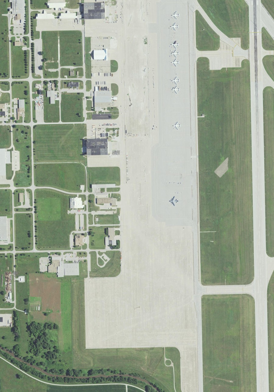
Grid north is up. The West/Corn Side pad is at lower left; East/Plane Side is at lower right. True north is about 1.460° counterclockwise.
| Source | Use |
|---|---|
| USGS NAIP | 0.667 m output pixels in one UTM 14N frame. |
| USGS 3DEP | 2 m output raster sampled at 8 m terrain vertices. |
| SCCA event map | Venue extent and East/West grid placement checks. |
| Aerial observations | Grass boundaries, nine approximate buildings and 38 trees. |
Import the desired event course in the editor, calibrate its scale, then use the rotation dial, Move course and pixel fields to align it. The base location has no event cone layout. Scenery heights are estimates; in-game acceptance remains on your PC.
SCCA Lincoln venue · Solo Nationals and official East/West maps · SCCA paddock reference · USGS aerial service · USGS elevation service · Lincoln frame details
Real site context, carried into the sim.
The Beeville demo exports now use a best-fit USGS NAIP aerial crop for the ground material and a resampled 2018 USGS 1 m LiDAR surface for broad grades and drainage shape. The editor image retains source paint; exported cells use gray concrete, near-black asphalt and muted green grass, with a wider dark visual seam at concrete/grass transitions and subtle aggregate/slab-joint detail in the concrete so the edge remains legible at speed.
| Source | Use in the export |
|---|---|
| USGS NAIP orthophoto | Embedded aerial overlay plus class-specific concrete, asphalt and grass material variants. |
| 2018 USGS 1 m DEM | Compact height grid with terrain-aware normals in the exported ground mesh. |
| SCCA 2025 Day 1 / Day 2 maps | Course geometry, cones, gates and driving direction remain sourced from the official PDFs. |
The aerial-to-map registration is a best-fit visual alignment, not a survey. LiDAR is appropriate for broad slope and drainage feel; it does not establish slab joints, cracks, patches or individual bumps. Verify the result in Assetto Corsa against known pavement landmarks.
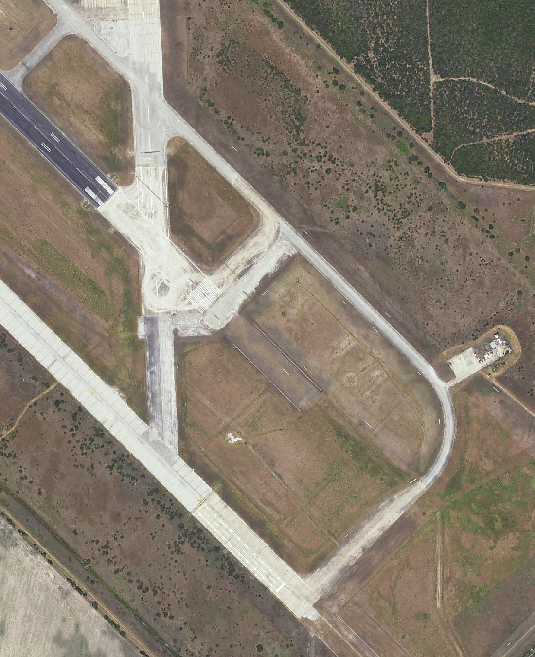
Enhanced embedded ground crop; the unmodified aerial is also included in the source packet.
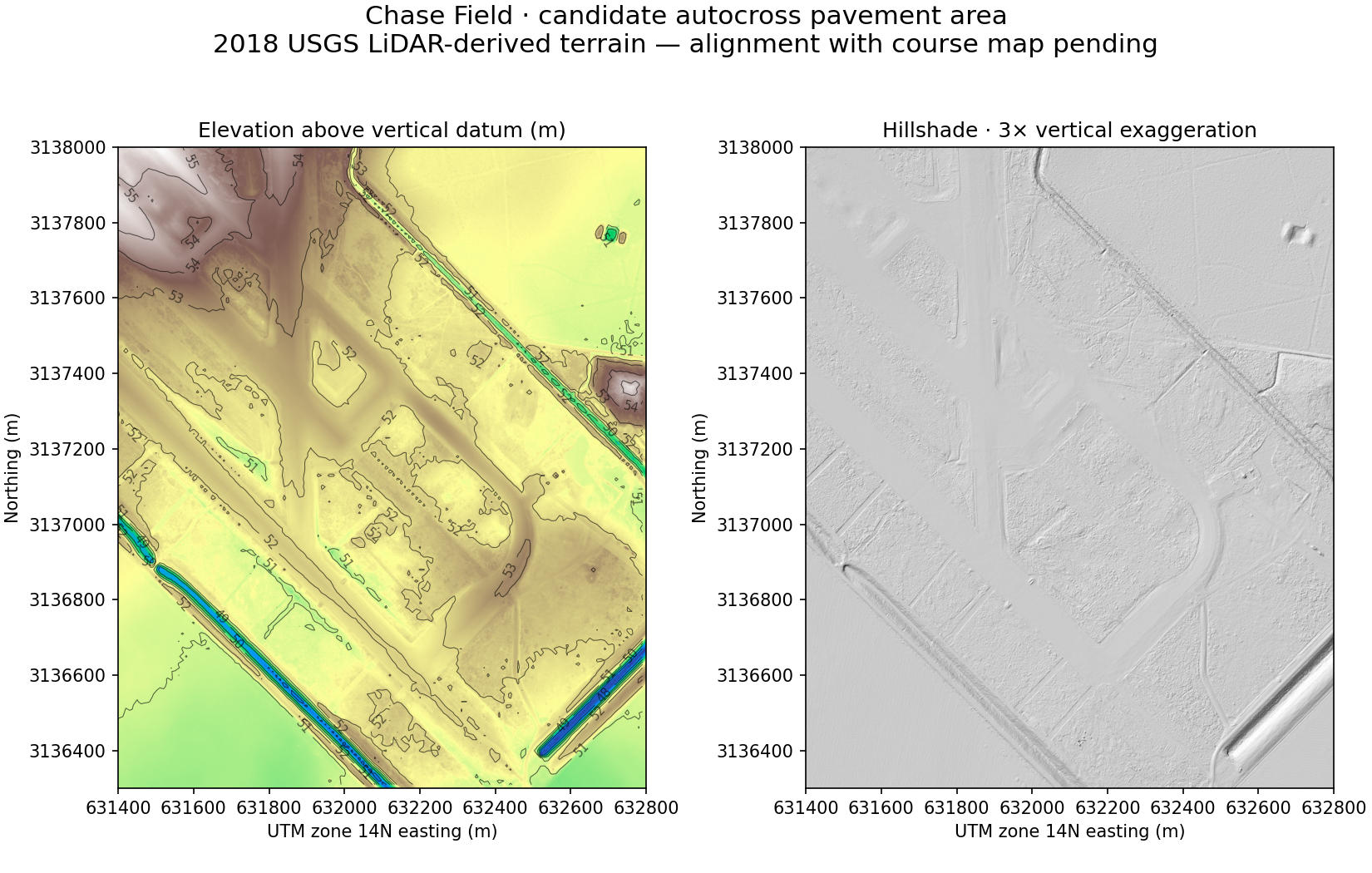
Regional LiDAR context; the exported grid uses the matching candidate course-area crop.
Download the elevation, aerial and provenance packet
Official National Tour test cases
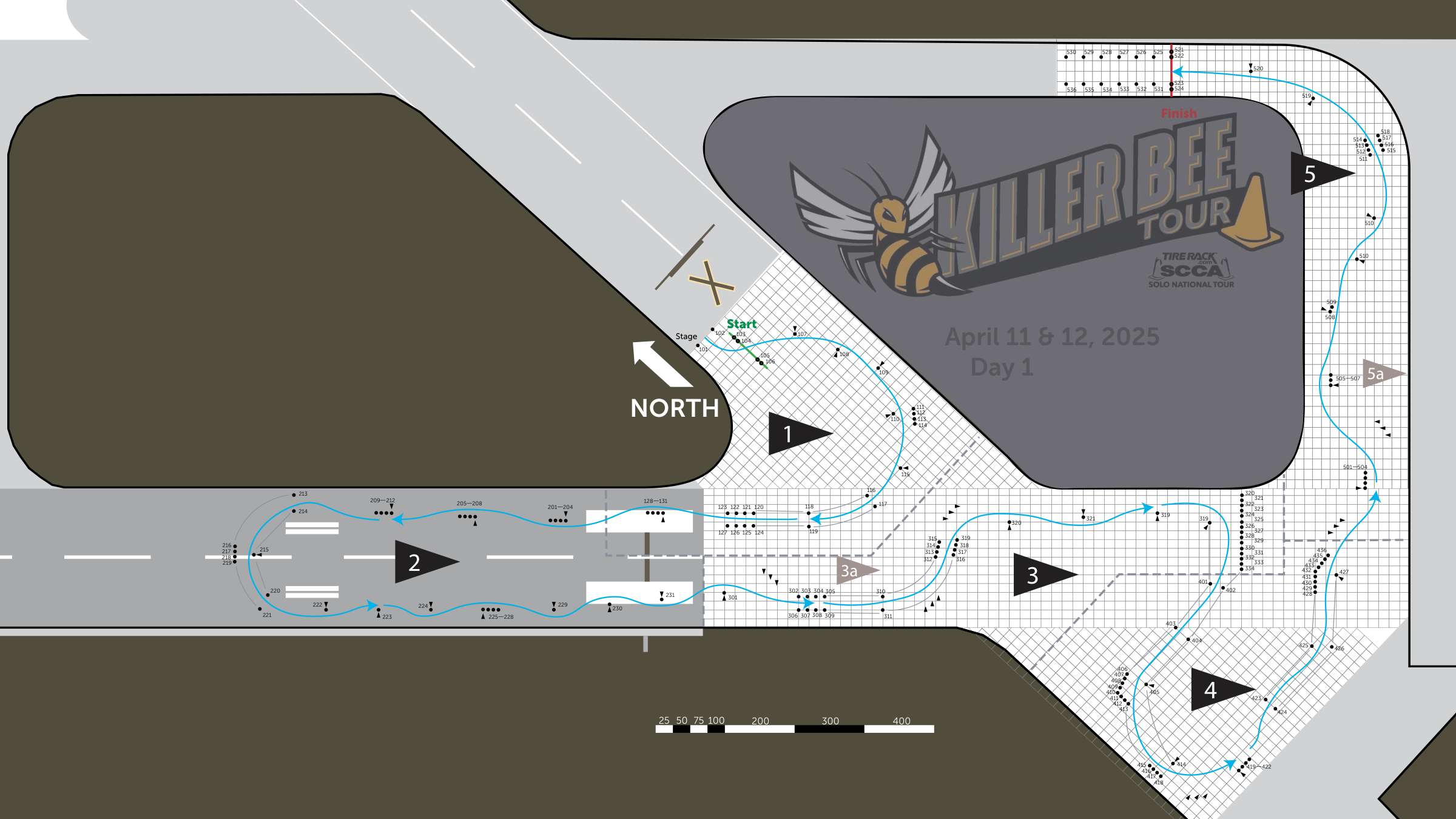
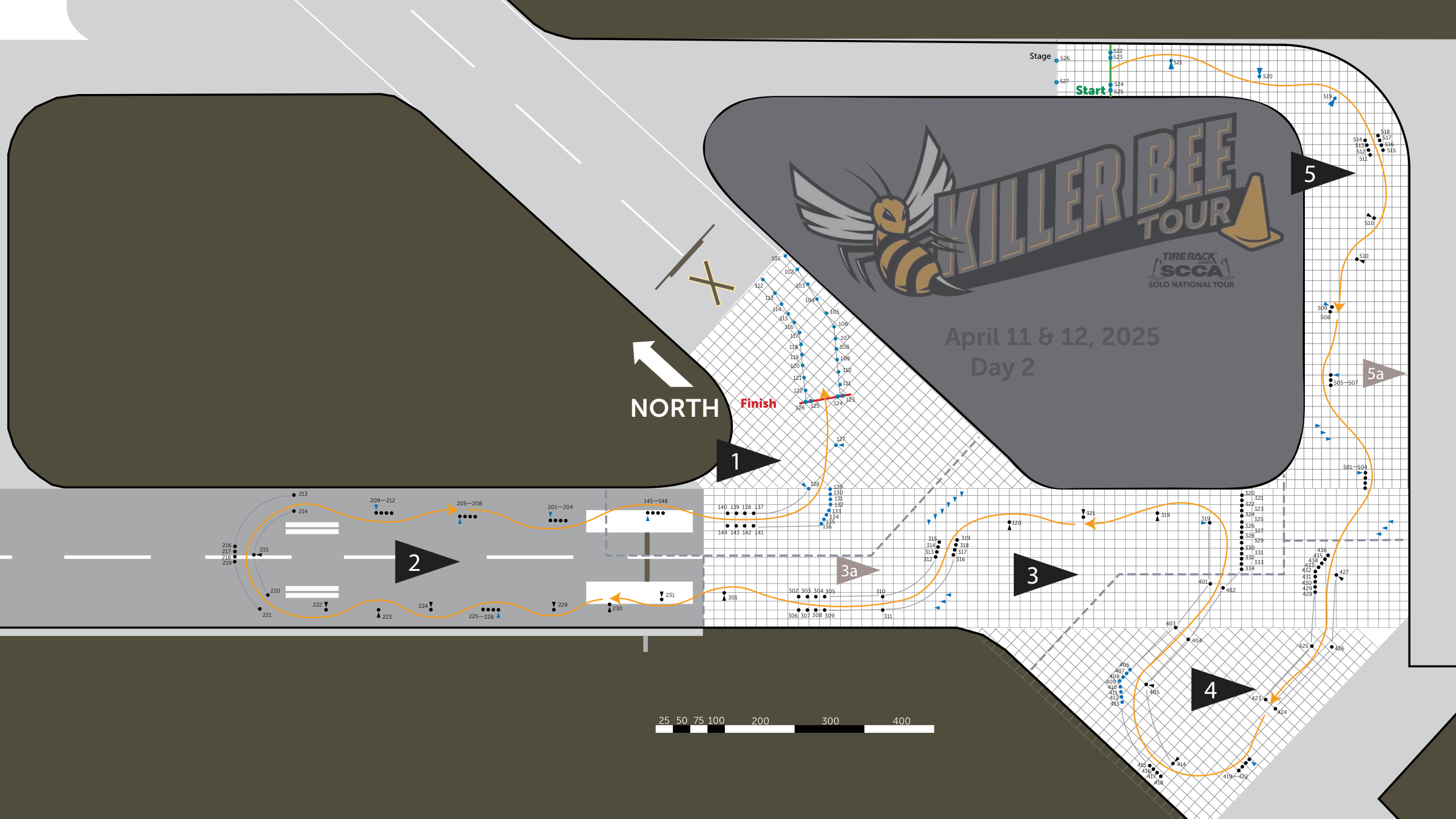
Start with the ten-cone Physics Test ZIP for timing, cone movement and scoring. The realistic site surface is included in the Day 1 and Day 2 validation ZIPs.